I'm a geologist, illustrator, animator, former Graphics Editor for National Geographic Magazine, and now Product Engineer for Esri. I keep a portfolio of my past work here and occasionally blog about cartography, computer graphics, and volcanoes.
National Geographic: Print
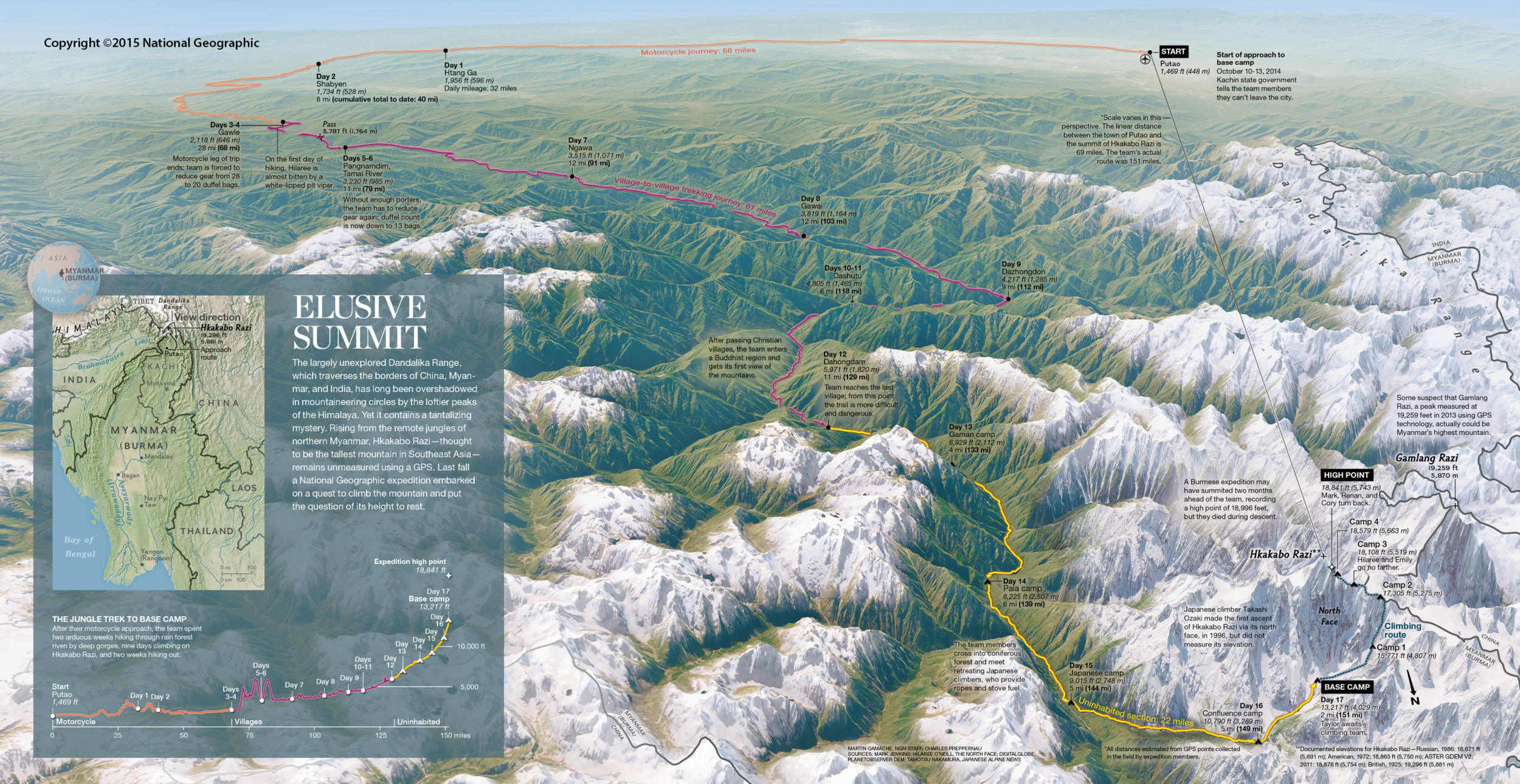
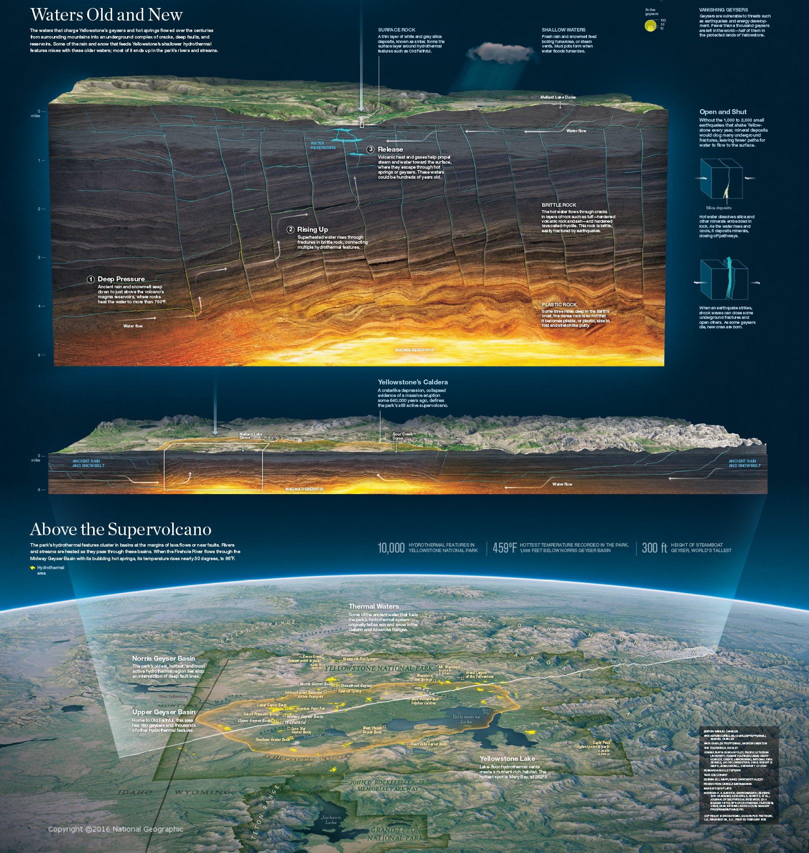
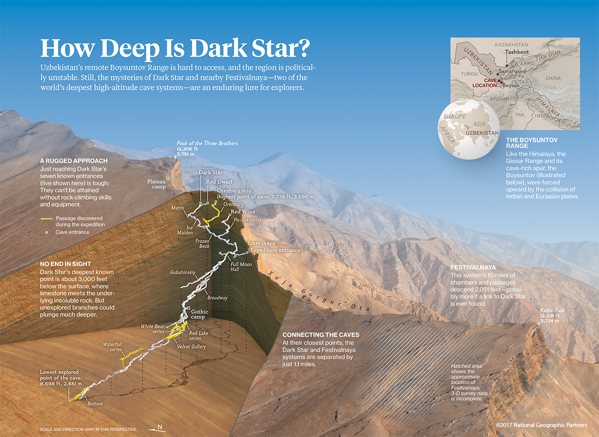
These are the magazine maps that I've created for National Geographic Magazine.
National Geographic: Online/Interactive
This was the interactive counterpart to the Grand Canyon piece in the magazine (shown above). I created the render of the terrain and carried out the GIS processing to correctly place the trek route, as well as the points of interest. I also animated the camera movement and translated it into data that our web developer, Chan-Young Park, could then use to control the way the map pans when the user scrolls.
This was a news map that I worked on with fellow cartographer Lauren James. I produced the 3D terrain blocks in the lower half of the image.
This was a news map made in response to the accident that claimed the life of North Face founder Douglas Tompkins.
For the interactive companion to our magazine piece on Yellowstone, I obtained the 3D magma reservoir models and positioned them at their appropriate location and depths. During part of the design we intended to show the position of the mantle plume relative to the earth's core, while at the same time we had a model of the few hundred meters of ground surrounding Old Faithful geyser; the scales used in this this animation thus spanned six powers of ten. To preserve the quality of imagery at each scale, I produced several different 3D maps, each visible at a particular range of scales, that were composited into the final scene.
research, academic, and personal projects
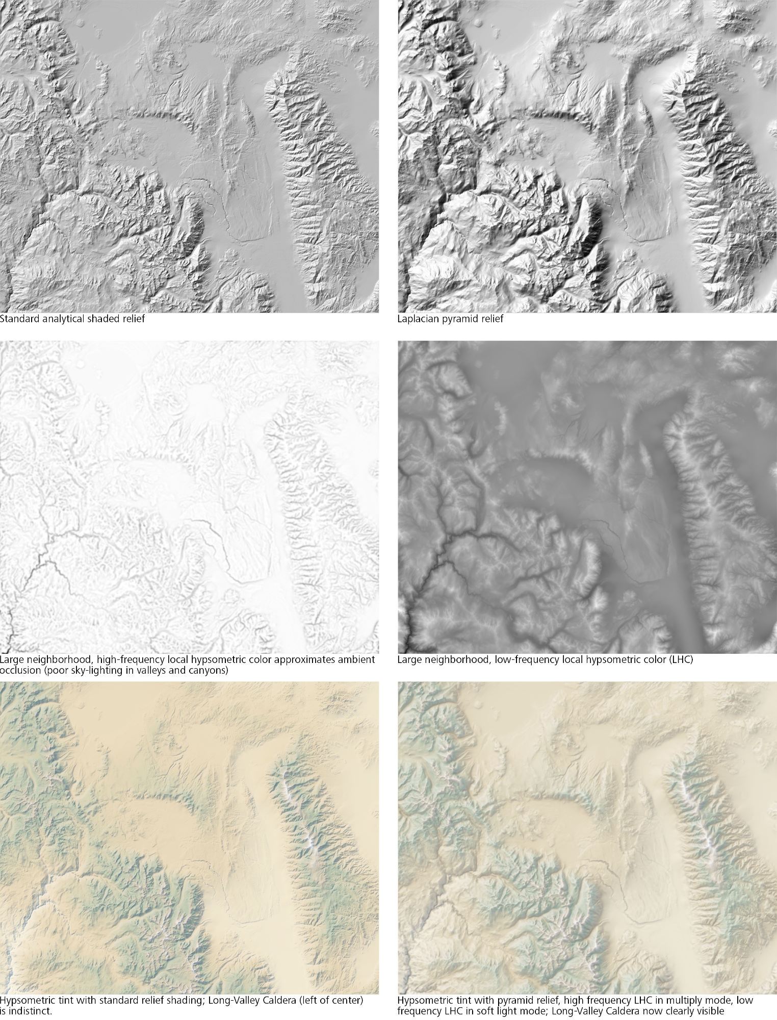
These are examples of maps and graphics I've produced as part of my academic career; they were made for research papers, classwork, and my own experimentation in cartography.
Interactive
This is a D3-powered interactive Sankey Diagram I made for the Willamette Water 2100 Project. It is based on model data for several different climate scenarios, forecast out to 2100. The primary dynamic of concern here is that precipitation for this watershed is not actually expected to decrease much, even in dramatic climate change scenarios. However, since more of that precipitation will fall as rain rather than as snow, less of it will be stored into the dry months, potentially leading to shortages during the summer.
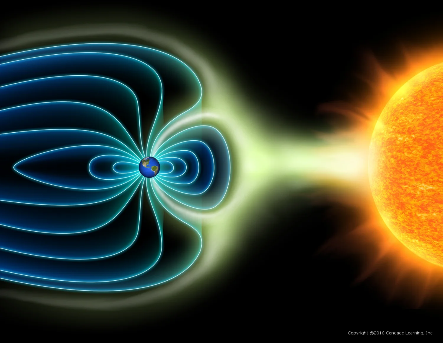
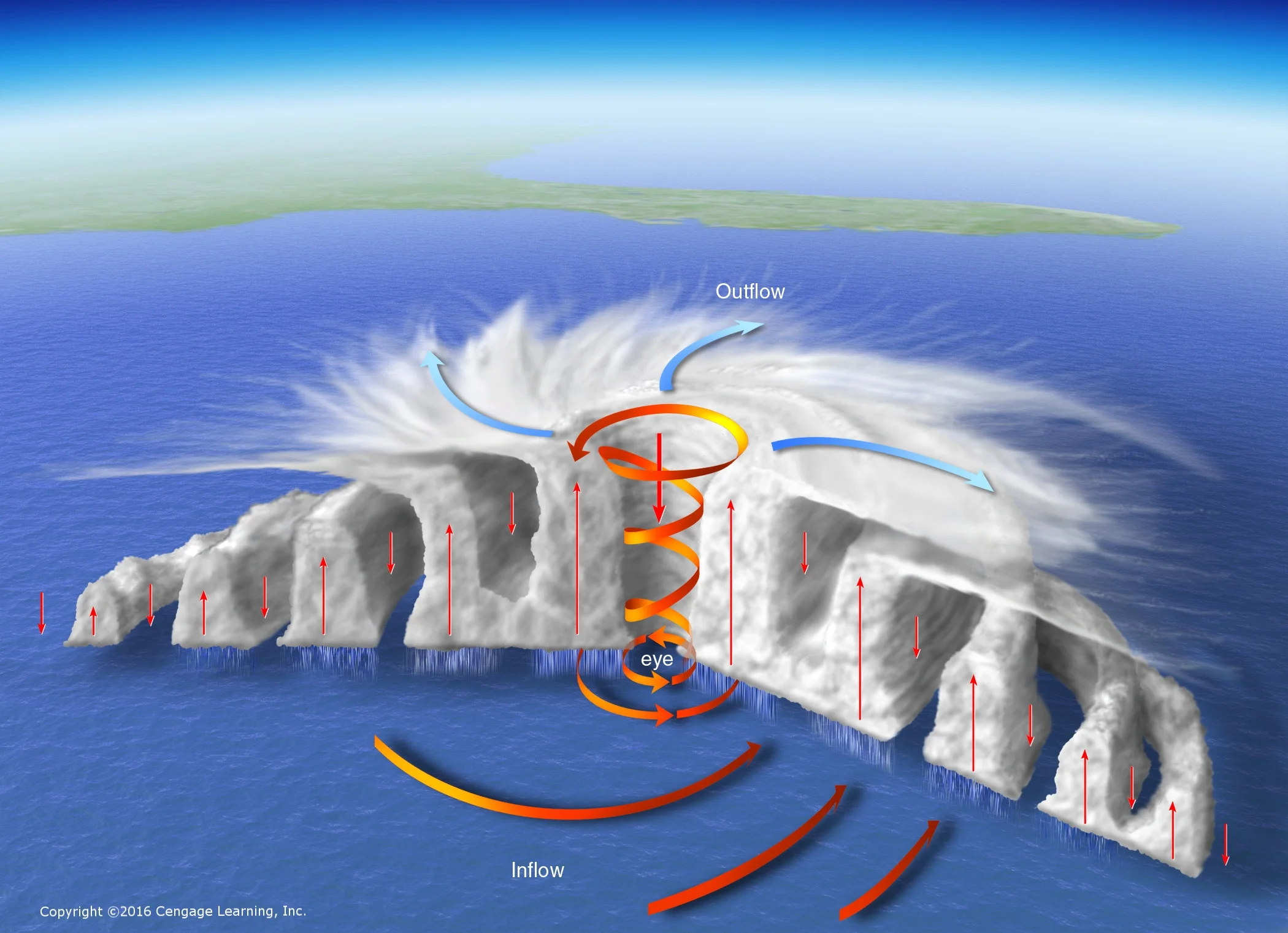
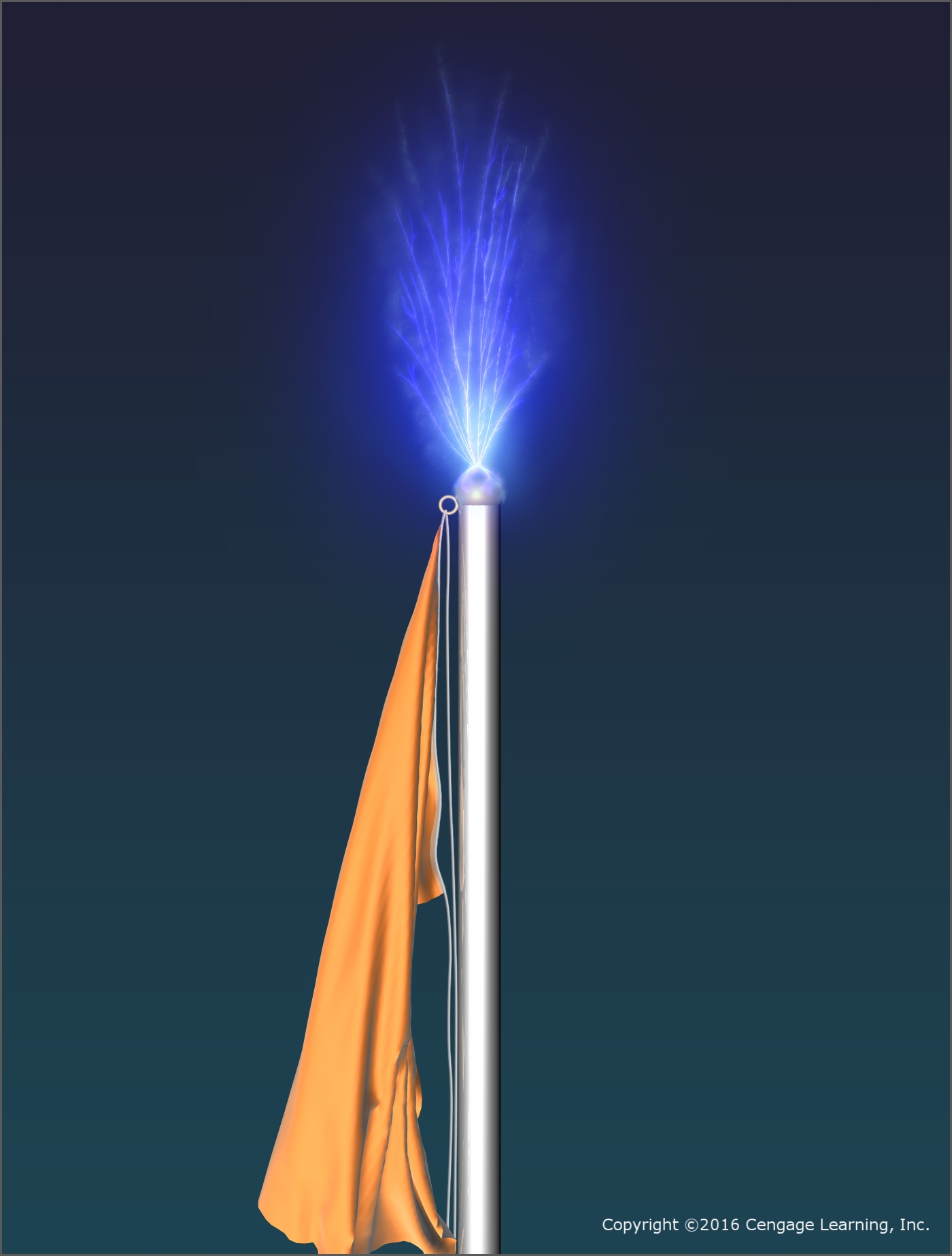
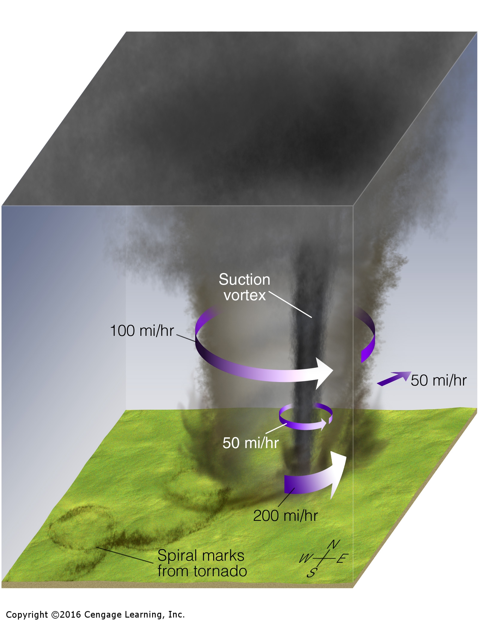
Meteorology Today/Essentials of Meteorology
I started my illustration career working on these two textbook series by C. Donald Ahrens and, recently, Bob Henson. They are now in their 11th and 8th editions, respectively.
Animations for Criminal and civil trials
Due to non-disclosure agreements and court orders, I can't post any actual content for this work, but I produce animations for prosecution teams around the US. These are usually homicide or manslaughter cases, and my work generally involves modeling the victim and their organs to show external and internal injuries, recreating the crime scene from police photos, and animating plausible mechanisms of injury and death that are consistent with the injuries shown and the context of the crime scene.